


गंगा नदी का उद्गम
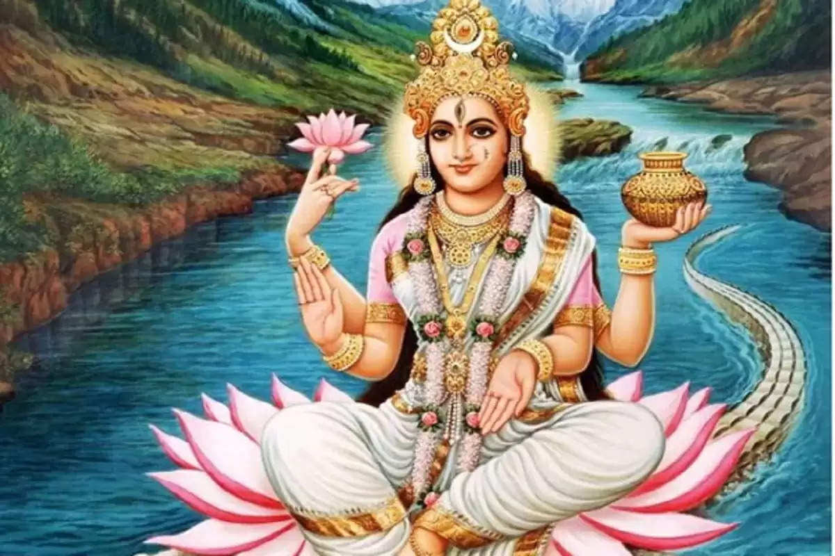
गंगा नदी की प्रधान शाखा भागीरथी है जो गढ़वाल में हिमालय के गौमुख नामक स्थान पर गंगोत्री हिमनद या ग्लेशियर(GURUKUL) से निकलती हैं। गंगा के इस उद्गम स्थल की ऊँचाई 3140 मीटर है। यहाँ गंगा जी को समर्पित एक मंदिर है। गंगोत्री तीर्थ, शहर से 19 कि॰मी॰ उत्तर की ओर 3,892 मी॰ (12,770 फीट) की ऊँचाई पर इस हिमनद का मुख है। यह हिमनद 25 कि॰मी॰ लंबा व 4 कि॰मी॰ चौड़ा और लगभग 40 मीटर ऊँचा है। इसी ग्लेशियर से भागीरथी एक छोटे से गुफानुमा मुख पर अवतरित होती हैं। इसका जल स्रोत 5,000 मीटर ऊँचाई पर स्थित एक घाटी है। इस घाटी का मूल पश्चिमी ढलान की संतोपंथ की चोटियों में है। गौमुख के रास्ते में 3,600 मीटर ऊँचे चिरबासा ग्राम से विशाल गौमुख हिमनद के दर्शन होते हैं। इस हिमनद में नन्दा देवी, कामत पर्वत एवं त्रिशूल पर्वत का हिम पिघल कर आता है। यद्यपि गंगा के आकार लेने में अनेक छोटी धाराओं का योगदान है, लेकिन 6 बड़ी और उनकी सहायक 5 छोटी धाराओं का भौगोलिक और सांस्कृतिक महत्त्व अधिक है।
क्यों श्री हनुमान जी ने चीरा अपना सीना ?
अलकनन्दा (विष्णु गंगा) की सहायक नदी धौली, विष्णु गंगा तथा मन्दाकिनी है। धौली गंगा का अलकनन्दा से विष्णु प्रयाग में संगम होता है। यह 1372 मीटर की ऊँचाई पर स्थित है। फिर 2805 मीटर ऊँचे नन्द प्रयाग में अलकनंदा का नन्दाकिनी नदी से संगम होता है। इसके बाद कर्ण प्रयाग में अलकनंदा का कर्ण गंगा या पिंडर नदी से संगम होता है। फिर ऋषिकेश से 139 कि॰मी॰ दूर स्थित रुद्र प्रयाग में अलकनंदा मन्दाकिनी से मिलती है। इसके बाद भागीरथी व अलकनंदा 1500 फीट पर स्थित देव प्रयाग में संगम करती हैं यहाँ से यह सम्मिलित जल-धारा गंगा नदी के नाम से आगे प्रवाहित होती है। इन पाँच प्रयागों को सम्मिलित रूप से पंच प्रयाग कहा जाता है। इस प्रकार 200 कि॰मी॰ का सँकरा पहाड़ी रास्ता तय करके गंगा नदी ऋषिकेश होते हुए प्रथम बार मैदानों का स्पर्श हरिद्वार में करती हैं।
Origin of river Ganga
The main branch of river Ganga is Bhagirathi, which originates from the Gangotri Glacier or GURUKUL at a place called Gaumukh in the Himalayas in Garhwal. The height of this place of origin of Ganga is 3140 meters. There is a temple dedicated to Ganga ji here. Gangotri shrine, 19 km north of the city, is the mouth of this glacier at an altitude of 3,892 m (12,770 ft). This glacier is 25 km long and 4 km wide and about 40 meters high. From this glacier, Bhagirathi descends on a small cave face. Its water source is a valley located at an altitude of 5,000 meters. The origin of this valley is in the peaks of the Santopanth of the western slope. On the way to Gaumukh, there is a view of the huge Gaumukh glacier from Chirbasa village, 3,600 meters high. The snow of Nanda Devi, Kamat mountain and Trishul mountain melts in this glacier. Although many small streams have contributed to the shape of the Ganga, but the geographical and cultural importance of 6 big and their tributaries 5 small streams is more.
Why Did Shri Hanuman Ji Cut His Chest ?
The tributaries of Alaknanda (Vishnu Ganga) are Dhauli, Vishnu Ganga and Mandakini. Dhauli Ganga meets Alaknanda at Vishnu Prayag. It is situated at an altitude of 1372 meters. Then Alaknanda meets Nandakini river at 2805 meters high Nand Prayag. After this, Alaknanda meets Karna Ganga or Pindar river at Karna Prayag. Then Alaknanda meets Mandakini at Rudra Prayag, 139 km from Rishikesh. After this Bhagirathi and Alaknanda confluence at Dev Prayag situated at 1500 feet, from here this combined water-stream flows further under the name of river Ganges. These five Prayags are collectively called Panch Prayag. In this way, after covering 200 kilometers of narrow hilly path, the river Ganga touches the plains for the first time in Haridwar via Rishikesh.
और भी मनमोहक भजन, आरती, वंदना, चालीसा, स्तुति :-
- कृष्णा भजन मैशप वॉल्यूम 2
- क्यों मनाई जाती है गंगा सप्तमी
- गंगा नदी
- तू है मोहन मेरा मैं दीवाना तेरा
- माखन खा गयो माखनचोर
- तेरे फूलों से भी प्यार
- जोगन भेस बनाया
- जबसे बांके बिहारी हमारे हुए
- जो श्याम पर फ़िदा है
- हमने भरोसा कर लिया सरकार श्याम का
अगर आपको यह लेख अच्छा लगा हो तो कृपया इसे अन्य लोगो तक साझा करें एवं किसी भी प्रकार के सुझाव के लिए कमेंट करें।
अगर आपको यह भजन अच्छा लगा हो तो कृपया इसे अन्य लोगो तक साझा करें।